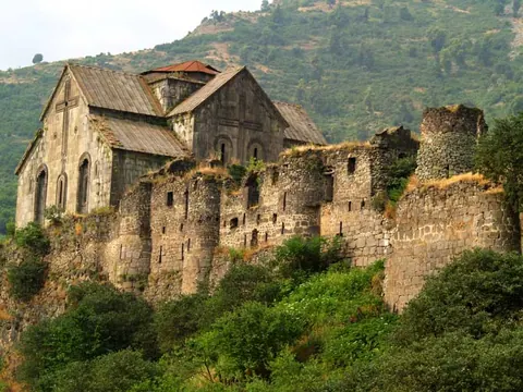
A fortified monastery whose church is covered, wall to wall, in early-13th-century frescoes.
Akhtala (also Pghindzavank, the "copper monastery") sits inside the walls of a fortress on a cliff above the Shamlugh river. Its frescoes were commissioned by Ivane Zakarian around 1205–1216 and are among the best preserved medieval wall paintings in Armenia.
Good to know
- Bring a phone light for the frescoes on dull days.
- A small entrance fee to the fortress grounds may apply.
Read more: Wikipedia: Akhtala Monastery
Getting there
127 m above the Debed river, which runs 1.3 km away in a straight line.
| From | Road distance | Drive time |
|---|---|---|
| Vanadzor | 66 km | 1 h 14 min |
| Alaverdi | 19.5 km | 25 min |
| Stepanavan | 60.1 km | 1 h 04 min |
| Yerevan | 181.2 km | 3 h 13 min |
| Tbilisi | 100.3 km | 1 h 55 min |
Details
- Type
- Church
- Where
- Akhtala
- Elevation
- 708 m
- Built
- 10th–13th c.
Light
Golden hour is when the sun is less than 6° above the horizon — the warm light for photos. In deep gorges the sun leaves the valley floor earlier.
Photos taken nearby
From Wikimedia Commons, within 1 km. Click a photo for its author and licence.
Weather at Akhtala Monastery
Loading the forecast…
Forecast for 708 m from Open-Meteo.
On these routes
- Debed Canyon in one day 1 day
- Yerevan to Tbilisi through Lori 1–2 days
Sights nearby
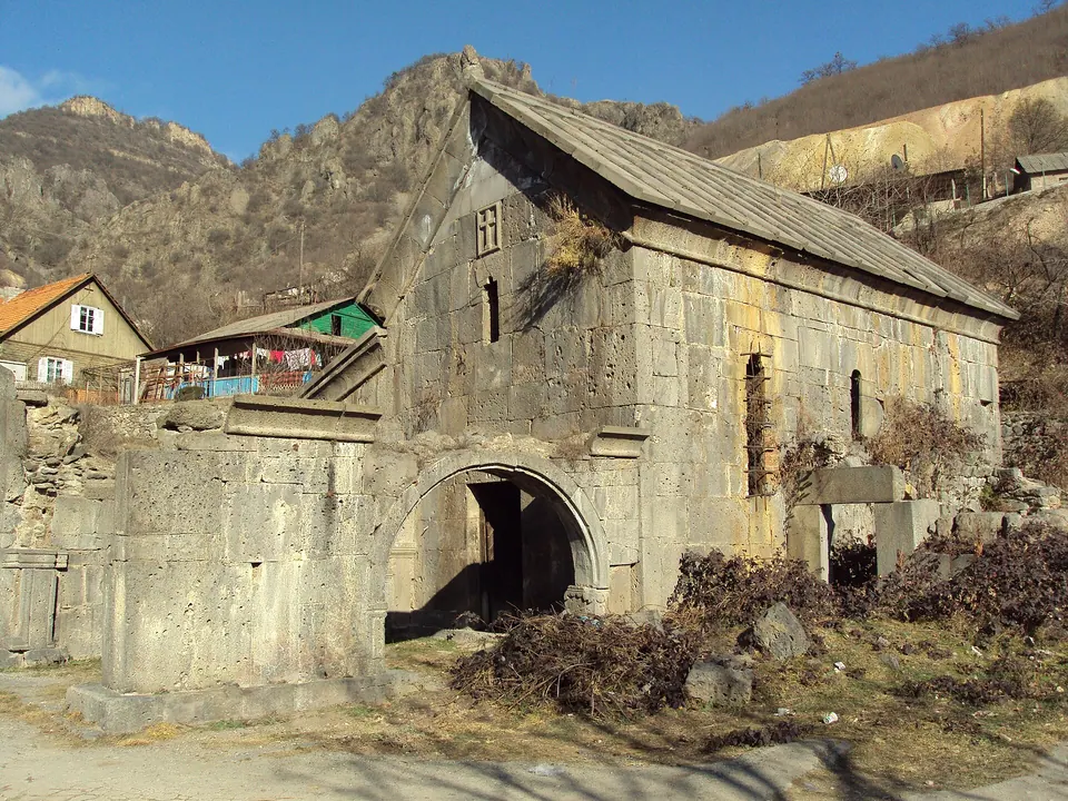
- Saint George churchChurch 350 m 25 m higher
- Trinity churchChurch 400 m same level
- Aramyants Castle / MansionManor 2.0 km same level
- Khachkar Garik Sargsyani HishatakinMonument 4.6 km 505 m higher
- Viewpoint near TsaghkashatViewpoint 6.0 km 1,029 m higher
- Monument of World War 2Monument 6.5 km 59 m lower
Nature nearby
- KarakatarPeak 3.1 km 561 m higher
- KarutPeak 3.3 km 728 m higher
- GugutPeak 4.0 km 871 m higher
- LerkondPeak 4.4 km 773 m higher
- KhratanotsPeak 5.4 km 879 m higher
Stay nearby
- Hotel in NeghotsHotel 1.8 km 127 m lower
- Elen B&BGuesthouse 1.8 km 127 m lower
- CypressGuesthouse 2.4 km 41 m higher
- Camping freeCampsite 3.4 km 160 m lower
- Camping freeCampsite 3.4 km 160 m lower
Eat nearby
- NurikRestaurant 200 m 28 m higher
- BistroFast food 2.2 km 148 m lower
- Nice FoodFast food 5.1 km 72 m lower
- Cafe in ShnoghCafe 5.4 km 175 m lower
- Restaurant in TeghutRestaurant 7.2 km 64 m lower
Services nearby
- HaypostPost office 4.6 km 507 m higher
- Fuel in ShnoghFuel 5.5 km 169 m lower
- Chochkan medical ambulatoryClinic 6.6 km same level
- VTBATM 7.2 km 67 m lower
- Fuel in HaghpatFuel 7.5 km 49 m lower
Distances in the "nearby" lists are straight-line; the height difference shows how much climbing a short distance can hide here.