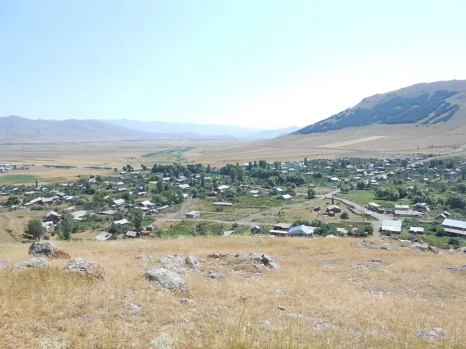
Hartagyugh is a town in the Lori Province of Armenia. The village was founded in 1820 by Western Armenian immigrants. The ancestors of the inhabitants came from Basen, Mush, Erzurum, Alashkert, Van and Kars. The settlement has existed since the 4th millennium BC.
Getting there
On the Pambak river.
| From | Road distance | Drive time |
|---|---|---|
| Vanadzor | 42 km | 43 min |
| Alaverdi | 87 km | 1 h 30 min |
| Stepanavan | 64 km | 1 h 05 min |
| Yerevan | 119.6 km | 2 h 02 min |
| Tbilisi | 199.2 km | 3 h 14 min |
Details
- Type
- Village
- Where
- Spitak & the west
- Elevation
- 1,713 m
- Population
- 1,180
Light
Golden hour is when the sun is less than 6° above the horizon — the warm light for photos. In deep gorges the sun leaves the valley floor earlier.
Photos taken nearby
From Wikimedia Commons, within 1 km. Click a photo for its author and licence.
Weather at Hartagyugh
Loading the forecast…
Forecast for 1,713 m from Open-Meteo.
Sights nearby
- Surb NshanChurch 50 m same level
- Church in Ghaltaghchi St. HovhannesChurch 200 m 25 m higher
- Ghaltaghchi Surb HovanesChurch 800 m 34 m higher
- Surb Hovhannes MaturChurch 2.5 km 444 m higher
- Mets Parnii YekeghetsiChurch 5.7 km same level
Nature nearby
- Melkonants AghbyurSpring 7.5 km 243 m higher
Services nearby
- SAS&K marketSupermarket 550 m same level
Distances in the "nearby" lists are straight-line; the height difference shows how much climbing a short distance can hide here.