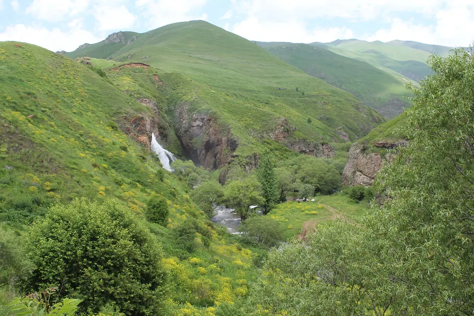
One of Armenia's tallest waterfalls, on the Chichkhan river at the Shirak border.
At its fullest in May–June with snowmelt. The last stretch is a short walk from the road; there are viewpoints both above and below the falls.
Good to know
- Muddy in spring — boots, not sneakers.
Read more: Wikipedia: Trchkan waterfall
Details
- Type
- Waterfall
- Where
- Spitak & the west
- Built
- natural
Light
Golden hour is when the sun is less than 6° above the horizon — the warm light for photos. In deep gorges the sun leaves the valley floor earlier.
Photos taken nearby
From Wikimedia Commons, within 1 km. Click a photo for its author and licence.
Weather at Trchkan Waterfall
Loading the forecast…
Forecast for this spot from Open-Meteo.
Sights nearby
- Viewpoint near SaralanjViewpoint 0 m
- Viewpoint near SaralanjViewpoint 0 m
- Viewpoint near SaralanjViewpoint 50 m
- Hianali Tesarannerov DitavayrViewpoint 1.3 km
- ShinarmatRuins 3.1 km
- Kyasants GomeryHistoric 3.1 km
Nature nearby
- Zuygaghbyur (Keri Aghbyur)Spring 3.3 km
- AqloraverPeak 4.0 km
- MetsmatPeak 5.1 km
- ErkaynasarPeak 5.7 km
- UrasarPeak 6.8 km
Stay nearby
- Gagik Palyan's houseGuesthouse 6.6 km
Services nearby
- Fuel near Mets ParniFuel 6.9 km
- Trchkan MarketSupermarket 6.9 km
- Fuel near Mets ParniFuel 6.9 km
Distances in the "nearby" lists are straight-line; the height difference shows how much climbing a short distance can hide here.