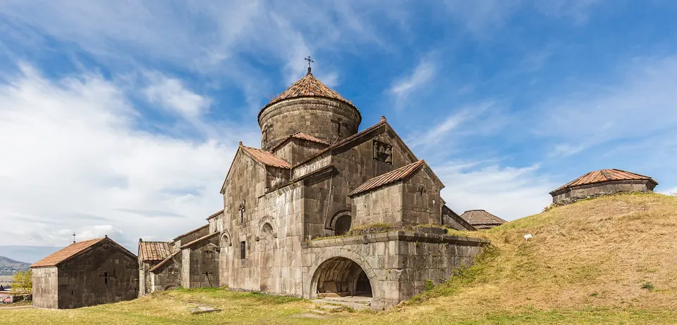
A UNESCO-listed monastery village above the Debed, founded in the 970s by the Bagratid queen Khosrovanuysh.
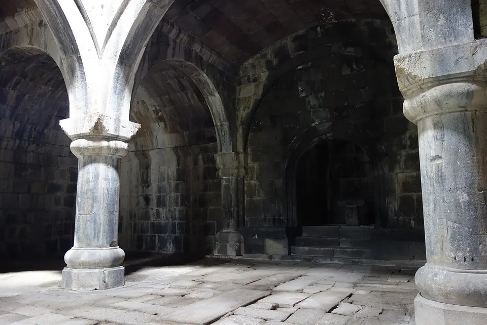
Haghpat grew into one of the great learning centres of medieval Armenia. Walk through the cathedral of Surb Nshan, the big gavit (narthex) with its intersecting arches, the free-standing bell tower and the library, and look for the Amenaprkich khachkar of 1273 — one of the finest carved cross-stones in the country.
Good to know
- Free to enter; services on Sundays.
- Go early or late: tour groups arrive around midday.
- Kayan fortress is a short walk down the road.
Read more: Wikipedia: Haghpat Monastery, UNESCO: Monasteries of Haghpat and Sanahin
Getting there
295 m above the Acher river, which runs 900 m away in a straight line.
| From | Road distance | Drive time |
|---|---|---|
| Vanadzor | 56.8 km | 1 h 03 min |
| Alaverdi | 10.4 km | 14 min |
| Stepanavan | 50.9 km | 54 min |
| Yerevan | 172 km | 3 h 02 min |
| Tbilisi | 108 km | 2 h 03 min |
Details
- Type
- Monastery
- Where
- Haghpat
- Address
- Haghpat
- Elevation
- 1,016 m
- Built
- 10th–13th c.
- Denomination
- Armenian apostolic
Light
Golden hour is when the sun is less than 6° above the horizon — the warm light for photos. In deep gorges the sun leaves the valley floor earlier.
Photos taken nearby
From Wikimedia Commons, within 1 km. Click a photo for its author and licence.
Weather at Haghpat Monastery
Loading the forecast…
Forecast for 1,016 m from Open-Meteo.
On these routes
- Debed Canyon in one day 1 day
- A Lori weekend from Yerevan 2 days
- Yerevan to Tbilisi through Lori 1–2 days
- Three slow days in the canyon 3 days
- Haghpat to Sanahin hike, Half a day
Sights nearby
- Haghpat bell towerChurch 0 m same level
- Hamazasp gavit, HaghpatChurch 0 m same level
- Surb Nshan Cathedral, HaghpatChurch 50 m same level
- Khatunashen S. AstvatsatsinChurch 50 m same level
- Surb Nshan Gavit, HaghpatChurch 50 m same level
- St. Gregory, HaghpatChurch 50 m same level
Nature nearby
- ArajnaglukhPeak 1.4 km 410 m higher
- Surb LuysPeak 2.5 km 841 m higher
- KoshaberdPeak 4.0 km 131 m higher
- AknerasarPeak 4.1 km 614 m higher
- ManesPeak 4.7 km 339 m higher
Stay nearby
- HaghpatHotel 100 m 25 m lower
- B&B EdemGuesthouse 250 m 48 m lower
- Guesthouse in HaghpatGuesthouse 300 m 64 m lower
- ColibriHotel 300 m 63 m lower
- Guesthouse MaryGuesthouse 400 m 46 m lower
Eat nearby
- Restaurant in HaghpatRestaurant 100 m 25 m lower
- Restaurant in HaghpatRestaurant 600 m 107 m lower
- Zarni-ParniRestaurant 800 m 241 m lower
- Lastuer RestaurantRestaurant 1.1 km 192 m lower
- AtorikRestaurant 1.4 km 350 m lower
Services nearby
- Fuel in HaghpatFuel 1.3 km 357 m lower
- Hatsi PurBakery 2.1 km 318 m lower
- AmbulatoriaHospital 2.1 km 27 m lower
- EV charging in AknerEV charging 2.2 km 302 m lower
- Mini MarketConvenience store 4.4 km 36 m lower
- ACBAATM 4.5 km 33 m lower
Distances in the "nearby" lists are straight-line; the height difference shows how much climbing a short distance can hide here.